Subscribe
to receive news by email

Poll
Will the Trump Administration Shift U.S. Policy in Favor of Palestine?
- No (87%)
- Yes (13%)
Copyright © 2025 Arab America
Go topHistory of the Israel-Lebanon Border
By: Liam Nagle / Arab America Contributing Writer
Like many colonial constructs in the Middle East, the border between Israel and Lebanon is relatively new. Created to separate portions of the British and French mandates, this territory has almost always been a battleground between Israeli forces and guerrilla groups. With tensions between Israel and the Lebanon-based Hezbollah reaching new heights and showing no signs of abating, it is important to reflect and ask the question: What led us here?
The Paulet-Newcombe Agreement – 1923
The border between Israel and Lebanon starts with the defeat of the Ottoman Empire after the First World War. Britain and France, the victorious powers, were now dividing the Middle East between themselves. Before the war, Lebanon had existed as a majority Maronite province within the Ottoman Empire, but the new agreements after the war would see changes to its provincial borders. The new borders would expand Lebanon to encompass more Sunni and Shia Arab populations, but still not quite enough to supersede the Maronite majority at the time.
Additionally, the new Lebanese entity would become the State of Lebanon, a subdivision of the greater French-controlled Mandate for Syria and the Lebanon. At the same time, Britain was establishing Mandatory Palestine. Having come under British control after taking the land from the Ottomans, Britain had initially agreed that a unified Arab state would control Palestine. However, the later revelation of the Balfour Declaration stated that Palestine would become a “national home” for the Jews. Additionally, the Sykes-Picot Agreement, which divided the Middle East between Britain and France, made it clear that Palestine was to come under British control.
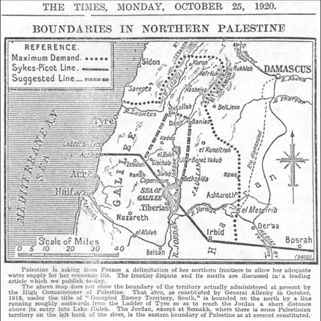
With Palestine being British-controlled and Lebanon being French-controlled, the two sides agreed to a border through the Paulet-Newcombe Agreement. In the agreement, the border between the two entities followed a variety of geographic features, including the “watershed of the valley of Jordan and the basin of the Litani”, and “the watershed between the Wadis Farah-Houroun and the Kerkera… and the Wadis El Doubleh, El Aioun, and Es Zerka”. The border stipulated in this agreement would remain unchanged during the French and British Mandates, and seemingly with little controversy.
The Green Line – 1949
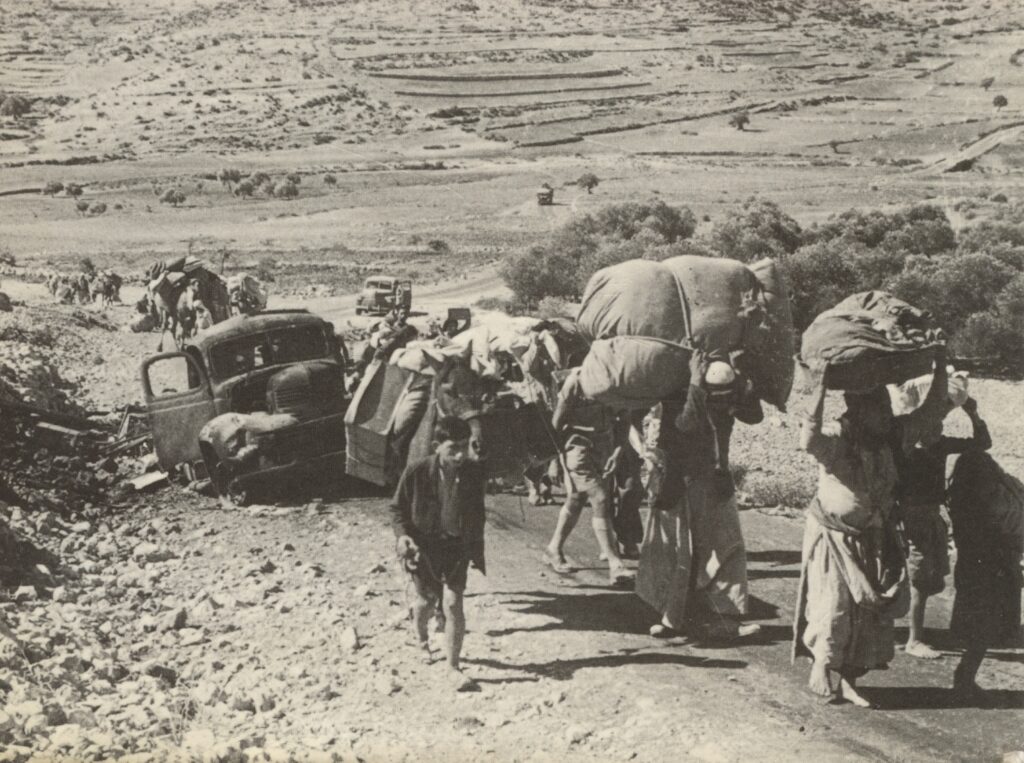
However, after Lebanon achieved its independence in 1943, and Israel was founded as a state in 1948, a coalition of Arab states – which included Lebanon – began an invasion of Israel. However, the war would result in a loss for the Arab states, resulting in discussions over the borders with Israel. Over the course of the war, Israel had successfully invaded Lebanon, occupying 13 villages in Lebanese territory. The resulting armistice agreement created the “Green Line” between Israel and various Arab states and, among other things, recognized that the armistice border would follow the international boundary defined in the 1923 Paulet-Newcombe Agreement. Given this, Israel withdraw its forces from the 13 occupied villages and recognized the agreement.
Unlike other borders that were created by the 1949 Armistice and the “Green Line”, where borders between Israel and the other Arab states were not considered permanent, the border between Israel and Lebanon were considered the official, international border between those two states.
Lebanese Civil War – 1978
Lebanon, entering the 1970s, was in a delicate situation. Receiving an influx of Palestinian refugees, the separation of governmental power along religious divides put the government in an awkward position. Additionally, the Palestinian Liberation Organization conducted operations against Israel from southern Lebanon while functioning as a smaller government within the Lebanese state. As a result, more and more Lebanese became increasingly wary of the PLO. Eventually, this resulted in inter-religious strife, attacks, and the eventual plummet into the Lebanese Civil War in 1975.
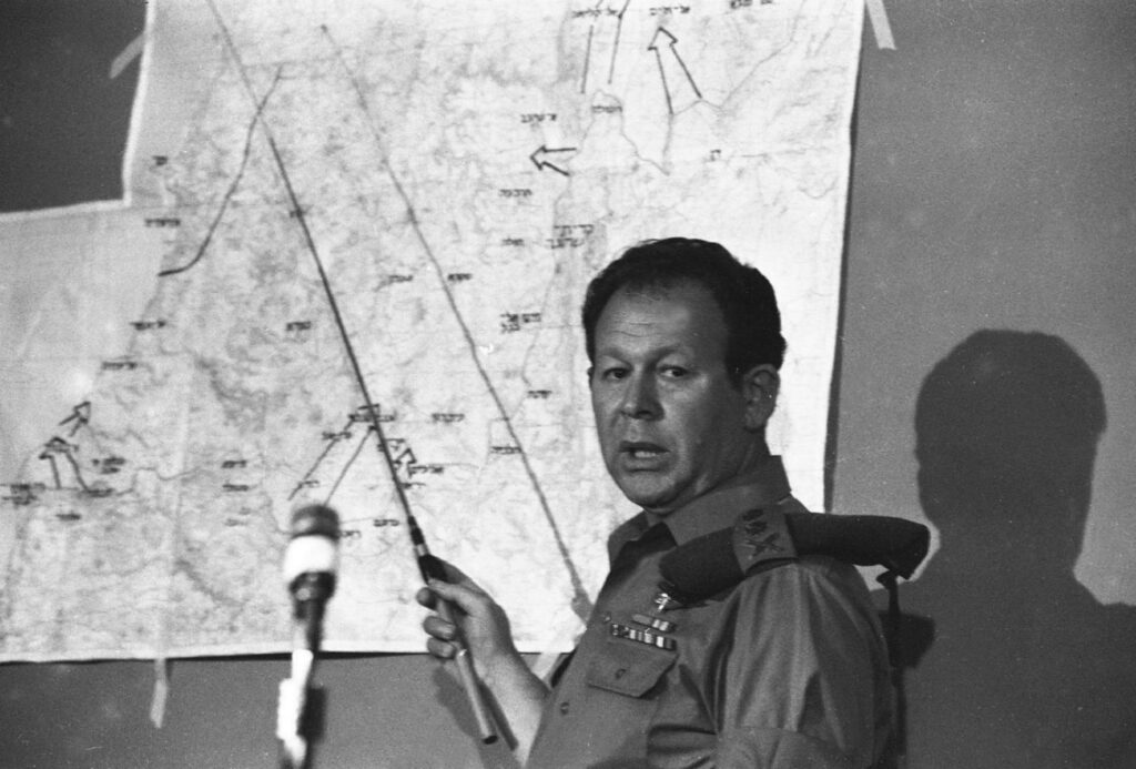
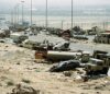
Israel, which sought to destroy the PLO, had conducted raids in Lebanese territory against the PLO, and with the outbreak of war, invaded Lebanon in 1978 under the name Operation Litani. Israeli forces invaded up to the Litani River in Lebanon. However, United Nations Security Council Resolution 425 called for the withdrawal of Israeli troops and the establishment of a UN-controlled buffer zone in southern Lebanon. This border, however, wouldn’t last long – in 1982, Israel invaded into Lebanon again to destroy the PLO. It bypassed the UN checkpoints, reaching as far as Beirut and even fighting battles against Syrian forces who were occupying parts of Lebanon as well.
Fearing a greater war, the United States negotiated the May 17 Agreement in 1984, resulting in the Israeli withdrawal to the Awali River in exchange for the PLO’s expulsion from Lebanon. In 1985, Israel withdrew further back to the Litani River, and the border between Israel and Lebanon remained de facto at the Litani River for another fifteen years.
The Blue Line – 2000
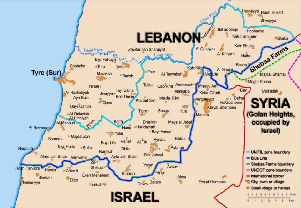
While the border would remain here for some time, skirmishes against Israel would continue. The newly formed Hezbollah would remain a powerful militia during and after the Lebanese Civil War. This resulted in both Hezbollah and Israeli forces engaging in various counterattacks against one another. As the tide was turning against Israeli forces, Israel stated that it would withdraw from Lebanon in accordance with UNSC Resolution 425 back in 1978. Israel withdrew to this new “Blue Line” in 2000, and UN observers confirmed this the same year.
Nevertheless, although the Blue Line mostly follows the older 1949 Green Line, disputes between the two states continue. Lebanon alleges that Israel is still in possession of Lebanese land. This includes the areas around Shebaa Farms, the village of Ghajar, and the hills around Kfarchouba, among others. However, discussions over these disputed territories have resulted in some resolutions, although not all have been resolved yet.
Despite ongoing disputes, the border between Israel and Lebanon, as established by the Blue Line, has remained relatively unchanged since its creation. Although attacks between Israeli forces and Hezbollah—stemming from airstrikes, raids, and other military actions—have been severe, they have not led to any adjustments in the border. However, with the outbreak of the War in Gaza in 2023 and Israel’s subsequent invasion of Lebanon, only time will tell what impact these events may have on the status of the border.
Check out our Blog here!


